
Before and After the Storm: Drone Property Records for Tampa Bay Owners
Hurricane season in Florida runs from June 1 to November 30, and Tampa Bay gets its share of tropical storms, high winds and heavy rain in between. When a storm passes, the first question for any property owner or manager is simple: what changed? Answering it is much easier when you have clear, dated photos of how the roof and property looked before the storm. This guide explains how drone imagery creates that record, what to capture before and after a storm, and what drone photos can and cannot do for you afterwards.
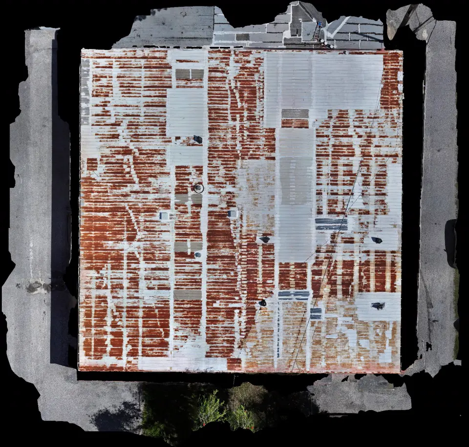
Why a before-the-storm record matters
After a storm, it is common to find damage and then struggle to show when it happened. Was that section of rust on the metal roof there last year? Were those shingles already lifting? Without a record, the answer often comes down to memory and a few phone photos taken from the driveway.
A drone flight before the season, or before a forecast storm, gives you sharp, dated photos of the whole roof and the property around it. If a storm does cause damage, you, your roofer and your insurance adjuster can compare the same views side by side instead of guessing.
What to capture before a storm
- The complete roof, as one stitched image, so every section is on record.
- Close photos of weak points such as flashing, vents, skylights, seams, ridge lines and past repairs.
- Rooftop equipment like AC units, solar panels and satellite dishes, and how they are fastened.
- All four elevations of the building, including gutters, soffits, windows and screen enclosures.
- The surrounding property: fences, trees close to the building, drainage areas, parking lots and outbuildings.
The best time is early in the season, in calm, dry weather. If a storm is already forecast, a flight a few days ahead can still help, but weather and other bookings may limit availability, so earlier is better.
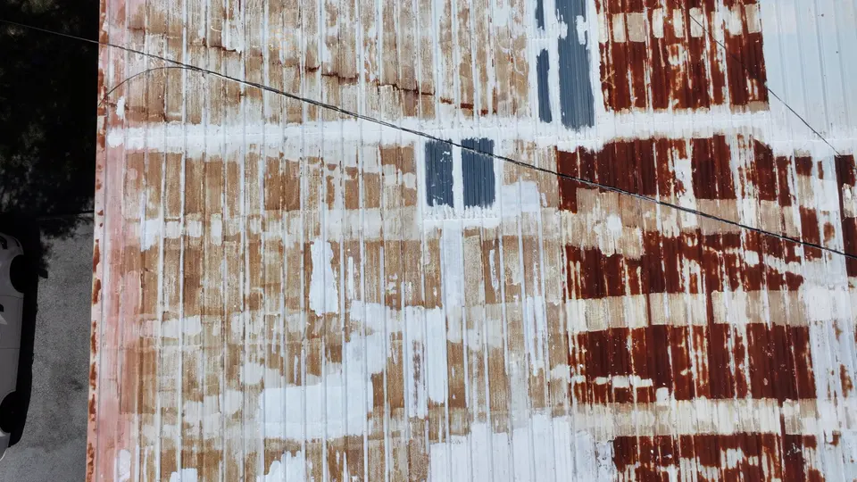
What to capture after a storm
Once it is safe to fly, the after-storm flight should repeat the same views as the first one: the full roof image, the same close-ups and the same elevations. Matching the angles is what makes the comparison useful. The flight should also look for anything new, such as:
- Missing, lifted or creased shingles and tiles.
- Peeled-back metal panels, loose flashing or damaged ridge caps.
- Shifted or damaged rooftop equipment and solar panels.
- Fallen trees or branches on or near the building.
- Debris on the roof and standing water where it does not normally collect.
- Damage to fences, screen enclosures, gutters and outbuildings.
Because nobody has to climb onto a roof that may already be weakened, a drone is often the safest way to get that first close look.
Comparing before and after
When both flights cover the same areas, the comparison is straightforward. The complete roof image can be divided into lettered zones, and each zone can be checked against its earlier photos. A short findings report then lists what changed in each zone, with the matching before and after images.
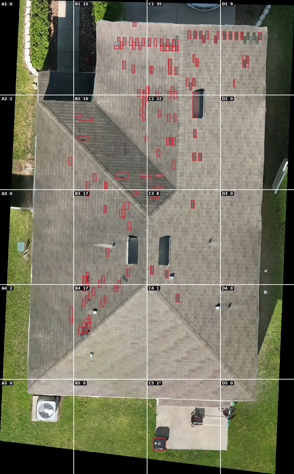
This gives a homeowner, property manager, roofer or adjuster the same clear set of photos, with dates, instead of a scattered collection of phone pictures.
Who benefits most
- Homeowners who want a dated record of their roof and property each season.
- Property managers and HOAs responsible for several buildings, where walking every roof is slow and costly.
- Commercial building owners with large metal or flat roofs and rooftop equipment.
- Owners planning a sale or refinance who want to show the roof's condition before and after storm season.
- Roofers and contractors who need clear photos to plan and quote repairs.
What drone photos cannot do
Drone imagery records what is visible from above and from the sides. It does not replace a licensed roofer, engineer or insurance adjuster. It cannot see inside the roof, measure moisture in the decking, or confirm structural soundness. It also does not guarantee that an insurance claim will be approved. Every policy is different, so check with your insurer or agent about what documentation they want. What drone photos can do is give you an accurate, dated visual record to support those conversations.
Flying after a storm: safety and airspace
After a major storm, the priority in the air belongs to emergency response. The FAA may set temporary flight restrictions over disaster areas so rescue, utility and news aircraft can work safely. A professional operator checks for these restrictions before every flight and waits until it is legal and safe to fly. Wind, rain, downed power lines and blocked roads can delay a flight as well. Imaging in the Sky is FAA Part 107 licensed and insured, and plans every flight around current airspace rules and conditions.
A simple storm record plan
- Early in the season: fly the full roof and property, and save the photos with the date.
- Before a forecast storm, if time allows: a quick update of the roof and weak points.
- After the storm, once it is safe and legal: repeat the same views and look for changes.
- Review and act: share the before and after photos with your roofer, contractor or insurer.
- Each year: repeat the early-season flight so the record stays current.
Common questions
How soon after a storm can you fly?
As soon as conditions are safe and any temporary flight restrictions over the area have been lifted. That can be the next day or a few days later, depending on the storm.
Do I need to be there during the flight?
Not usually. It helps to share the address, roof type, access details and anything you are concerned about ahead of time.
What do I receive?
Dated close-up photos, a complete stitched image of the roof, and, if included, a findings report that compares zones before and after.
Can drone photos replace a roofer's inspection?
No. They are a fast, safe first look and a clear record. If the photos show something concerning, a licensed roofer should check it in person.
See how roof and building aerial imagery works, read what to expect from a drone roof inspection, or send a few details about your property to plan a before-the-storm flight.