
Roof & building imagery
Roof & Building Aerial Imagery
Detailed photographs of the whole roof, plus one complete stitched roof image you can zoom into and review from your desk — without anyone climbing a ladder to take the pictures.
How it works
Many Photos. One Complete Roof.
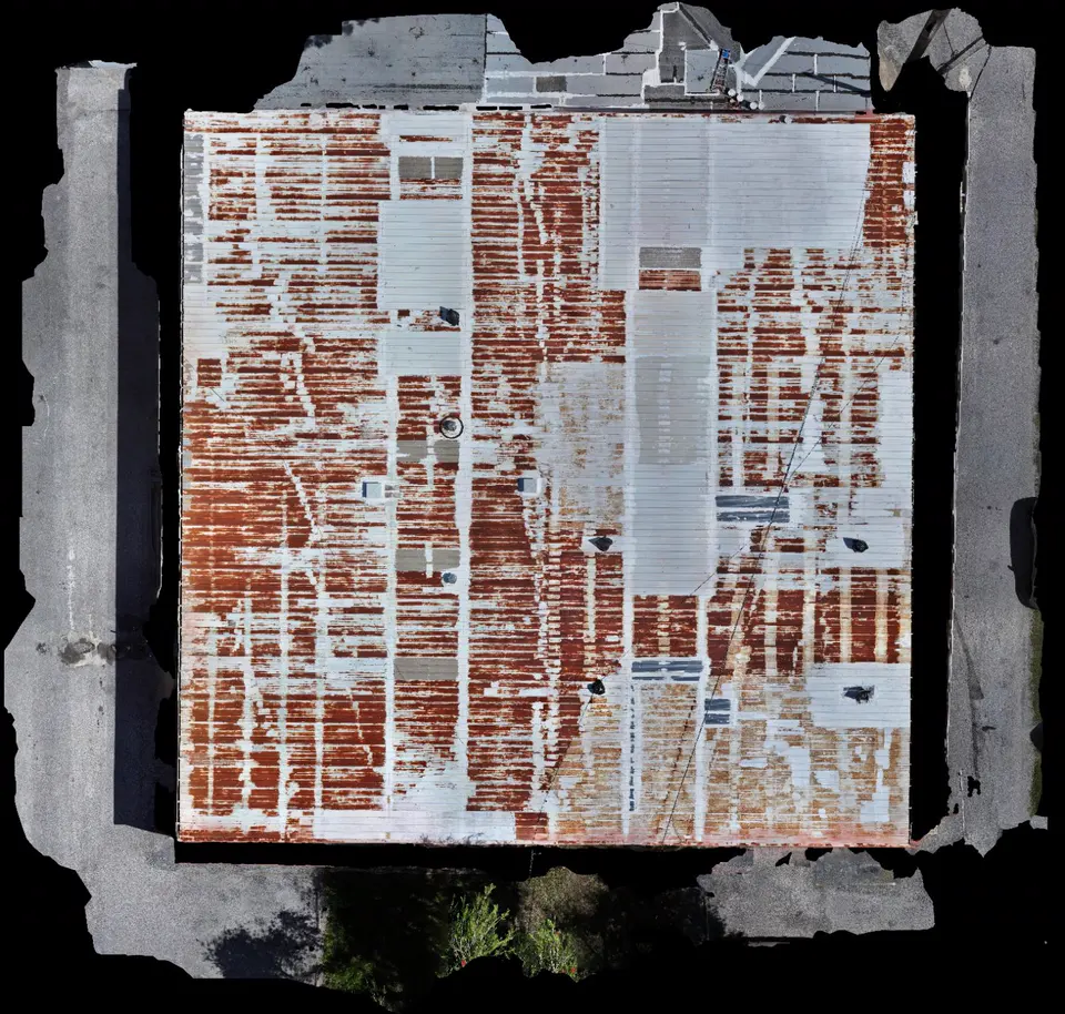
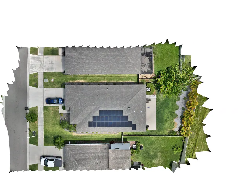
We fly a planned pattern over the roof and capture many detailed, overlapping images. Those images are then processed into an orthomosaic: a single top-down picture of the entire roof at consistent scale and detail.
You get both views — the complete roof image for the overall picture, and the individual close-up photographs for detail.
The detail photographs
The Same Roof, Up Close.
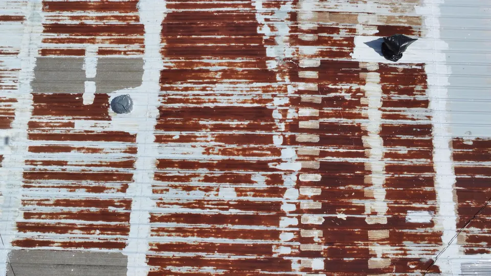
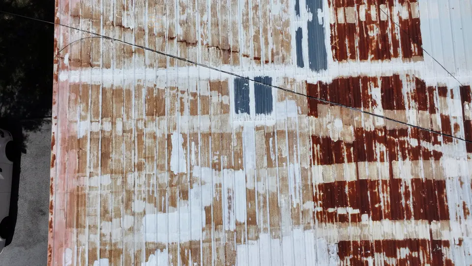
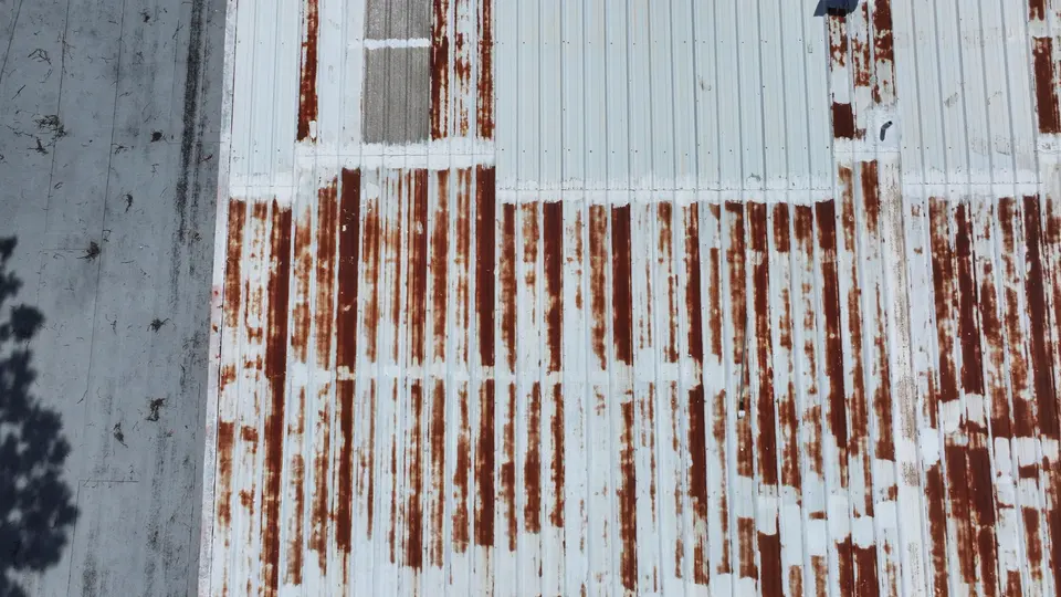
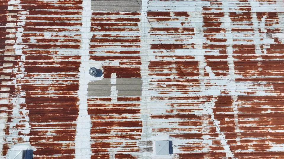
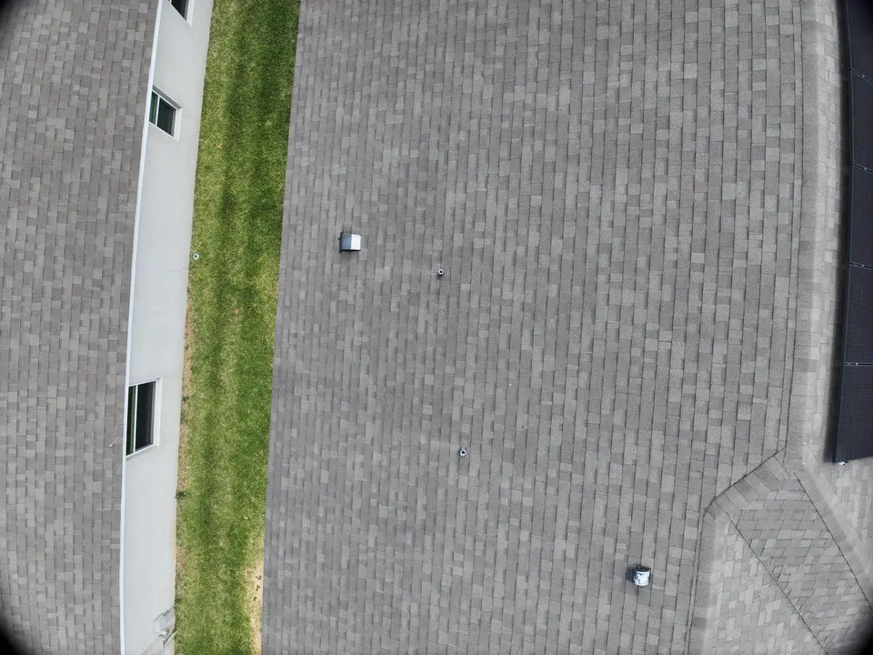
These are individual frames from the flight over the metal roof shown above. Each one is sharp enough to show coating, seams, fasteners, vents and surface rust, and each has a known place on the complete roof image.
In testing · findings report
Coming Next: A Report Your Roofer Can Work From.
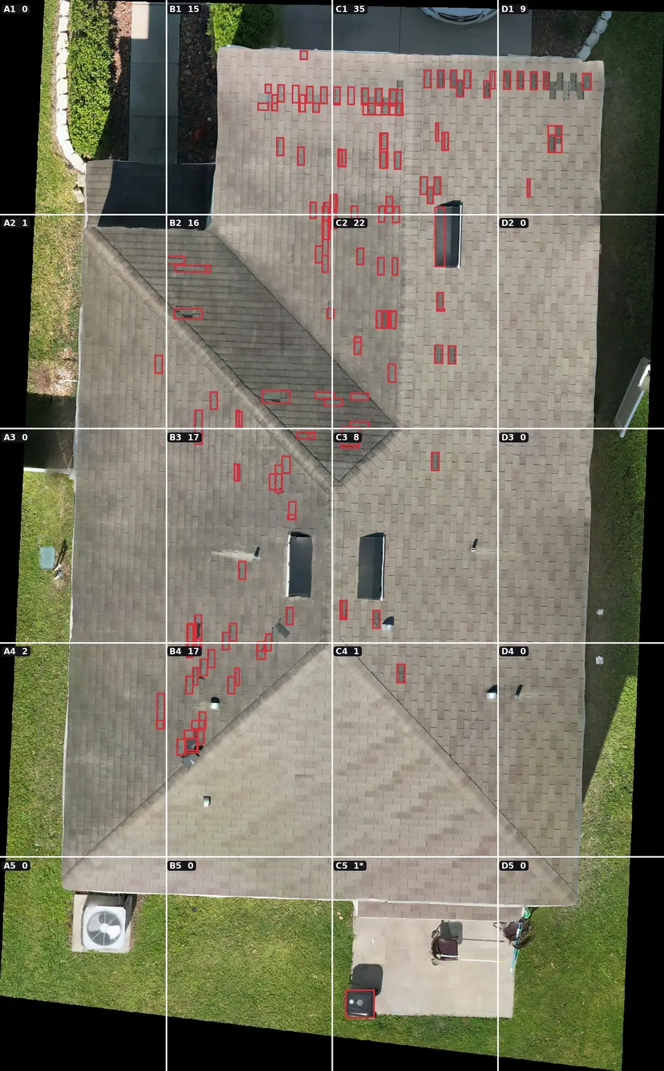
We are testing a findings report that goes a step beyond imagery. The complete roof image is divided into lettered zones, image-analysis software marks areas that look like possible missing shingles, and each zone is shown enlarged so every marked area can be found on the real roof.
This example is from our testing. If you would like one for your roof, ask when you request a quote.
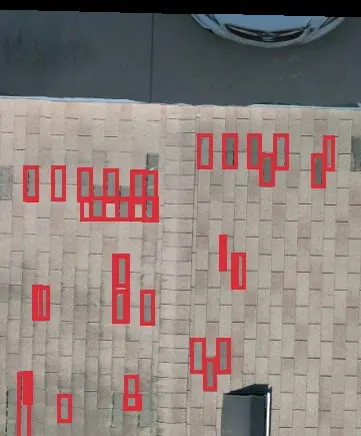
The marked areas are leads to check, not a diagnosis. The software can miss damage and can flag things that are not damage. The report does not confirm leaks, hidden damage, quantities or repair scope; your roofer confirms or dismisses each area on site.
Deliverables
What You Receive
- A complete stitched image (orthomosaic) of the roof
- The set of detailed close-up roof photographs
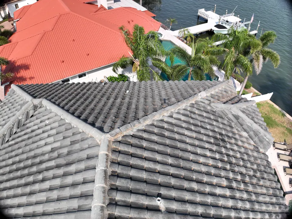
- Angled photos of elevations, edges and roof-mounted equipment where useful
- A simple report that organizes the imagery so areas of interest are easy to find
- Files you can forward to your roofer, adjuster, property manager or engineer
Good to know
Imagery, Not A Certification.
We document what is visible from the air. We are not roofing contractors, engineers or licensed inspectors, and we do not certify roof condition.
Aerial imagery can help identify visible areas that may deserve a closer look, and it gives the right professional a clear, complete picture to work from. It is also a useful dated record of a roof’s condition, for example before and after a storm or a repair.
Where it fits
Buildings We Photograph
- Large commercial and industrial roofs
- Multi-building properties and communities
- Steep or fragile residential roofs that are risky to walk
- Building exteriors and elevations that are hard to see from the ground
Example Roof Imagery
FAQ
Roof Imagery Questions
Is this a roof inspection?
It is roof imagery and a report for review. It does not replace an inspection by a qualified roofing professional, and we do not certify the condition of a roof. Many clients share our imagery with their roofer or adjuster.
What is a roof orthomosaic?
It is one complete, top-down image of the roof made by stitching many overlapping drone photographs together, so the entire roof can be reviewed in a single picture and zoomed for detail.
Does anyone need to go on the roof?
No. The imagery is captured from the air. That is safer and usually quicker, particularly for steep, tall or fragile roofs.
Can you document a roof before and after a storm or repair?
Yes. A dated set of images before and after an event or repair is a common request and gives a clear visual comparison.
Start a project
Tell us about the site.
Describe what you need photographed, mapped or documented and we’ll reply with a plan and a quote.