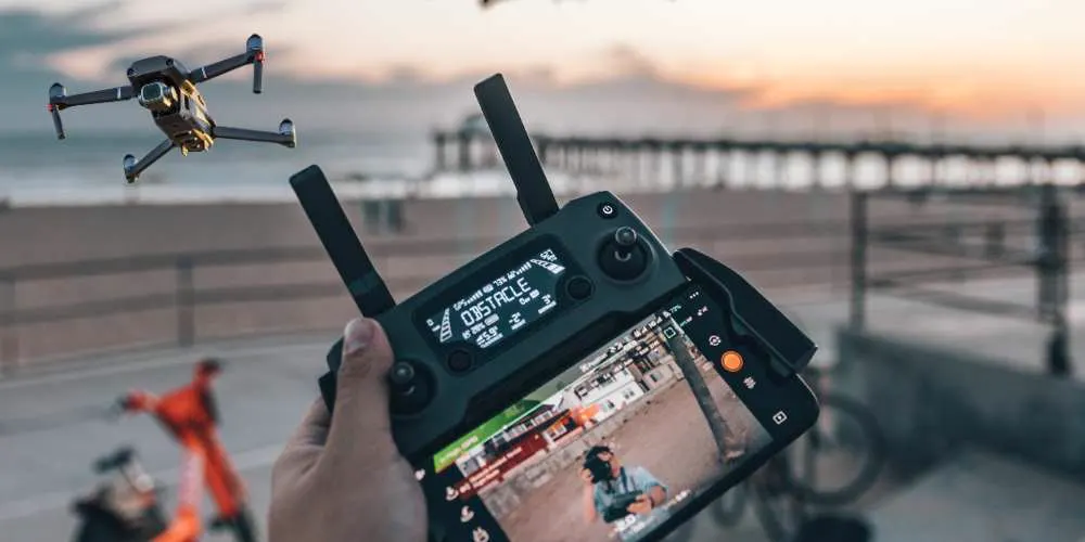
Construction Progress Photos for Tampa Bay Developers: A Practical Guide
When a project is moving fast, the people who are not on site every day still need to know what is happening. Owners, lenders, investors and project managers all want the same thing: a clear, current picture of the job without scheduling another site walk. Regular aerial photos give them that picture, and they leave a dated record you can look back on if questions come up later. This guide covers how construction progress photography works, how often to schedule it, what to capture, and what to look for when hiring a drone operator in the Tampa Bay area.
Why aerial progress photos work
Ground-level photos show a corner of the job. A drone shows the whole site in one frame: where the grading has reached, how far the structure has gone up, where materials are stacked, and how trucks move in and out. Taken from the same positions each visit, the photos line up, so changes between visits are easy to see without anyone having to explain them.
They also settle disagreements. When a schedule slips or a draw request is questioned, a dated photo of the site shows what was actually built and when. That is much easier than relying on memory or on a handful of phone pictures taken from different spots.
How often to fly
- Weekly during fast phases such as clearing, grading, utilities, foundations and framing, when the site changes noticeably from one week to the next.
- Every two weeks for steady stretches of vertical construction.
- Monthly for slower phases, or when a lender or investor only needs a monthly update.
The right schedule depends on the project, the budget and who needs the updates. It is worth agreeing on it before the first flight, so every visit is comparable. A consistent rhythm matters more than a high frequency: twelve evenly spaced monthly visits tell a better story than a few bursts of activity followed by gaps.
What to capture each visit
- A fixed set of overview angles, repeated every time, so you can compare any two dates side by side.
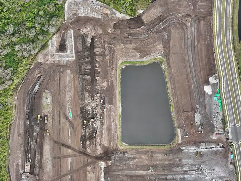
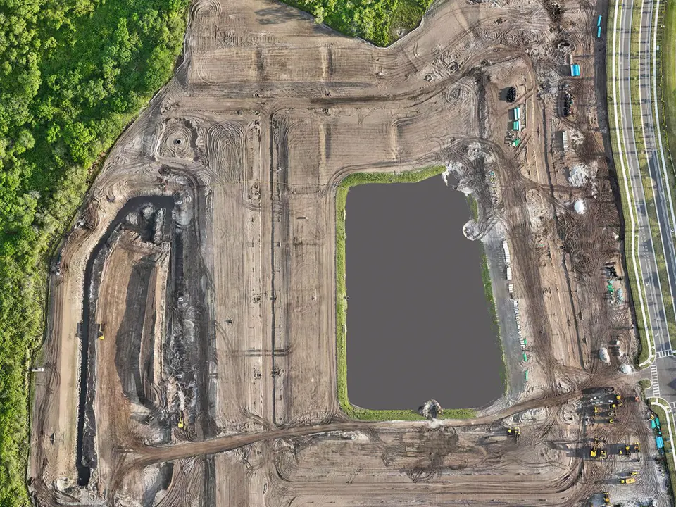
- A top-down view of the whole site, which makes grading, pads, roads and building footprints easy to read.
- Close views of active areas: the work happening that week.
- Access and staging areas, to catch congestion or storage problems before they become delays.
- Surrounding context such as adjacent roads, drainage and neighboring parcels, which matters on tight or sensitive sites.
- A short video pass for stakeholders who prefer to watch rather than scroll through stills.
Photos should be named and organized by date, so the record stays tidy and anyone on the team can find a specific week quickly.
Photos you can compare
The most useful deliverable is a before-and-after comparison: the same view on two dates. It is easy to share by email, works well in lender updates and owner meetings, and explains progress to people who have never visited the site. The two images in this article were taken seven weeks apart from the same position. The second shows grading and the retention pond further along.
What to look for in each phase
Site preparation and earthwork
Clearing, grading, stormwater features and haul roads. Aerial views make it easy to see whether earthwork is keeping pace with the schedule and how water is being managed on the site.
Utilities and foundations
Trenching, pads, slabs and early structural work. Dated photos help confirm the order of work and show where crews and equipment are concentrated.
Vertical construction
Framing, roofing and envelope work. A fixed angle from one side of the building shows height and completion at a glance, and a roof view shows how far decking and coverings have advanced.
Finishing and site work
Paving, landscaping, amenities and cleanup. The final photos double as a record of the finished site, which is useful for marketing, closeout and owner handover.
Who uses progress photos
- Developers and owners who are not on site daily and want to confirm schedule and quality.
- General contractors who need a clear record for owners, subs and inspectors.
- Lenders and investors who want visual support alongside draw requests and reports.
- Project managers coordinating several sites across Hillsborough, Pinellas, Manatee and nearby counties.
- Sales and marketing teams who can reuse the best images in brochures and websites.
What aerial photos are, and are not
Progress photos and video document how the site looks. They are not a substitute for a licensed surveyor when you need certified measurements, boundary work or construction layout. If a project needs survey-grade data, that work should be done by a licensed surveyor. Aerial documentation works alongside that work, not in place of it.
Working with a drone operator in Tampa Bay
Look for an operator who is FAA Part 107 licensed and insured, who agrees on a schedule and deliverables up front, and who is comfortable working around active job sites. Ask how photos are organized and delivered, how quickly you will receive them after each flight, and whether comparisons between dates are included. Local knowledge also helps: Florida weather, afternoon storms and airspace near airports all affect when and where flights can happen.
Imaging in the Sky is a Tampa Bay drone company serving developers, builders and project managers across the area, including Tampa, St. Petersburg, Clearwater, Brandon, Riverview, Wesley Chapel, Sarasota, Bradenton and Lakewood Ranch.
Common questions
Can you fly if the weather is bad?
Flights are postponed for rain, strong wind or lightning, and rescheduled as soon as conditions allow. Florida weather is one reason to agree on a flexible window rather than a single fixed day.
Do I need to be on site?
Usually not. A short check-in with the site contact is enough, and photos are delivered afterward.
Can the same photos be used for marketing?
Often yes. Progress photos from later stages make strong images for websites and brochures, and you can request a few extra shots when the building is nearly complete.
See how construction progress documentation works, or send a few details about your project for a quote.